About All Tours Boat ToursMonkey Island ToursWildlife Toursand Panama Canal Tours Directions Hours & Fees
Find Tours 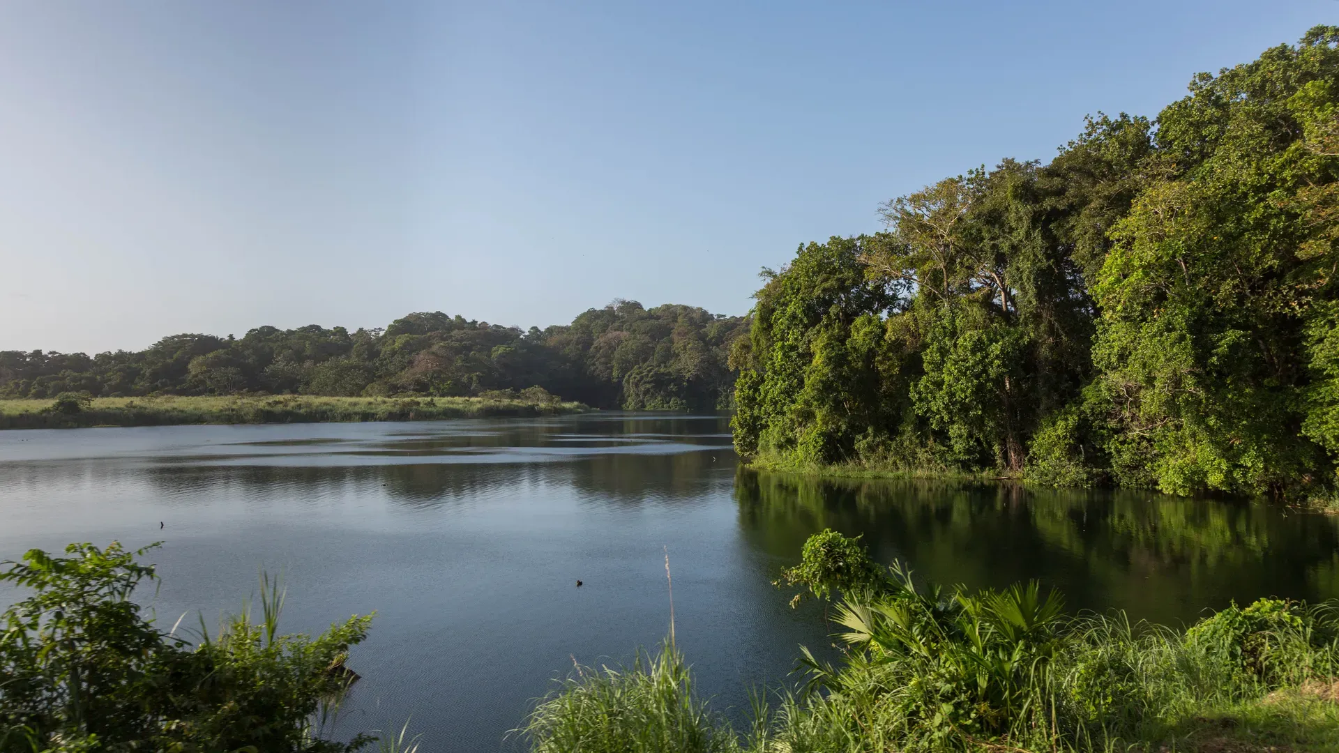
Gatun Lake is a 166-square-mile artificial reservoir south of Colón that forms the central 21-mile navigable corridor of the Panama Canal. Created in 1913 by damming the Chagres River, it powers global shipping locks while sustaining a dense tropical rainforest ecosystem.
Gatun Lake forms the 21-mile central corridor of the Panama Canal, allowing thousands of cargo ships to cross the Isthmus of Panama. The 166-square-mile reservoir sits 85 feet above sea level, holding the millions of liters of freshwater required to operate the canal's lock system. Ships transit directly through the flooded Chagres River valley. Heavy tropical rain feeds the lake, which in turn supplies drinking water to Panama City and Colón. The lake integrates a highly active global shipping lane with a dense, protected tropical rainforest ecosystem.
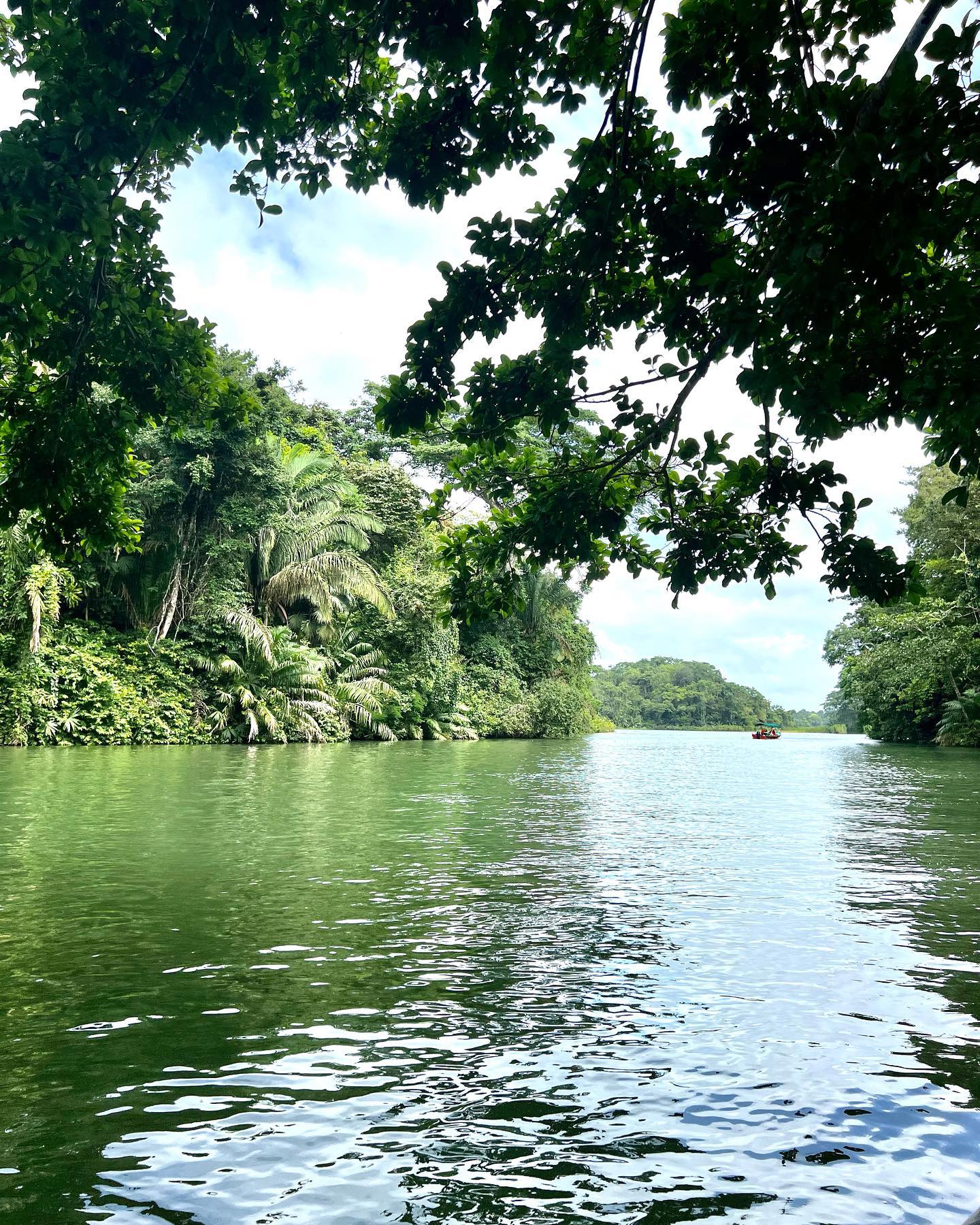
Thick jungle crowds the shoreline, creating an impassable green wall around the water. Submerged trees from the original 1913 flooding still lurk just beneath the surface, creating severe navigation hazards outside the marked shipping channels. Small open-air skiffs share the water with massive Neopanamax vessels and LPG tankers. The wake from these global giants hits smaller boats hard, often splashing water over the bow. Motion sickness medication helps if you have a weak stomach. The sheer scale of the cargo ships passing a few hundred yards away dwarfs the surrounding islands.
Dozens of islands dot the lake, formed from the peaks of former mountains that survived the flooding. Barro Colorado Island stands out as the largest, housing a Smithsonian Tropical Research Institute station that protects 480 tree species and 384 bird species. White-faced capuchins, howler monkeys, and spider monkeys swing through the canopy on the smaller Monkey Islands, also known as Islas Tigre or Islas Las Brujas. American crocodiles patrol the water, strictly prohibiting any swimming. Book a private boat tour for early morning, when cooler temperatures draw wildlife out of the deep canopy before the afternoon heat sets in.
The Agua Clara Visitor Center provides the primary land-based vantage point for the lake and the modern locks. Observation decks sit high above the water, offering a clear view of the 21st-century canal expansion. A moderate 1-kilometer ecological trail winds through the secondary forest near the center, giving visitors a close-up look at the local flora. Tickets cost B/.10.00 for non-resident adults. The lake itself is accessible 24/7 via tours, but the visitor center operates daily from 8:00 a.m. to 4:00 p.m. Call ahead to the visitor center before committing to your outing to check the day's ship transit schedule, ensuring you arrive when the massive cargo ships are actively passing through the locks.
American engineers took over the failed French canal project in 1904, shifting the design from a sea-level trench to a lock-and-lake system. Civil engineer George Goethals led the construction of the Gatun Dam across the Chagres River between 1907 and 1913. Workers piled earth and rock to create the largest earthen dam of its era. The gates of the spillway officially closed on June 27, 1913. Water backed up into the wooded valley, drowning the jungle floor and turning mountain peaks into isolated landmasses. The rising waters created the largest artificial lake in the world at the time.
Commercial transits began in 1914. Ships navigated 21 miles across the newly formed lake, bypassing the need to excavate millions of cubic yards of solid rock. The Smithsonian Tropical Research Institute established a biological reserve on Barro Colorado Island in 1923. Scientists used the newly isolated ecosystem to study tropical forest dynamics, cataloging thousands of flora and fauna species over the next century. The island became a heavily studied tropical forest.
Peacock bass entered the lake ecosystem by accident in 1958. A local businessman introduced the aggressive, non-native species to a small pond, which later flooded into the main reservoir during heavy rains. The bass decimated native fish populations but established a massive sport fishing industry. Anglers now pull 15-pound bass from the water with zero bag limits, as the government encourages the removal of the invasive species.
Engineers expanded the canal in 2016, adding the Agua Clara Locks to accommodate massive Neopanamax vessels. This upgrade required deepening the lake's navigational channels and raising the maximum operating water level to 87 feet. The Madden Dam, built further upstream on the Chagres River in the 1930s, regulates the inflow to prevent the lake from dropping below its minimum 82-foot operating threshold during the dry season. The expansion fundamentally changed the scale of traffic on the lake, replacing older Panamax ships with vessels capable of carrying 14,000 TEU containers. Check the daily transit schedule at the Agua Clara Visitor Center to time your visit with the passage of these 1,200-foot cargo ships.
Gatun Lake covers 430 square kilometers of the Panamanian isthmus, holding a maximum depth of 85 feet. The reservoir functions as a massive hydraulic battery. Every time a ship transits the canal, the locks release 52 million gallons of fresh water into the ocean. The lake relies entirely on the Chagres River watershed and heavy seasonal rainfall to replenish this constant drain. Madden Dam controls the primary inflow, while Gatun Dam manages the outflow, maintaining the water level within a strict five-foot operating range between 82 and 87 feet above sea level. If the water drops below 82 feet, the Canal Authority must restrict the draft of transiting ships.
The lakebed consists of a flooded jungle valley. Dead tree stumps from the 1913 inundation still breach the surface in shallow areas, petrified by the freshwater. These submerged forests restrict safe navigation to the dredged, central shipping channel. The surrounding topography features steep, jungle-covered hills that drop directly into the water. The flooding isolated the highest peaks, creating dozens of islands. Barro Colorado Island dominates the center of the lake, while smaller clusters like Islas Tigre and Islas Las Brujas sit closer to the shipping lanes. The shoreline remains highly irregular, characterized by deep inlets and narrow peninsulas formed by the original river tributaries.
The climate heavily dictates the physical state of the lake. October and November bring the heaviest rainfall of the Atlantic hurricane season. Flash floods and landslides frequently disrupt the shoreline during these months. The intense rain turns the water choppy, reduces visibility for boat captains, and drives wildlife deep into the canopy. The dry season, from December to May, exposes more of the shoreline and stabilizes the water surface. The Pan-American Highway provides direct access to the Gatun Dam area, taking about 59 minutes to cover the 50.8 miles from Panama City. Plan your visit between December and May to avoid the severe weather and secure calmer waters for boat transits. Bring a high-quality waterproof case or dry bag for your camera, as passing cargo ships create sudden wake waves that easily splash into small tour boats.
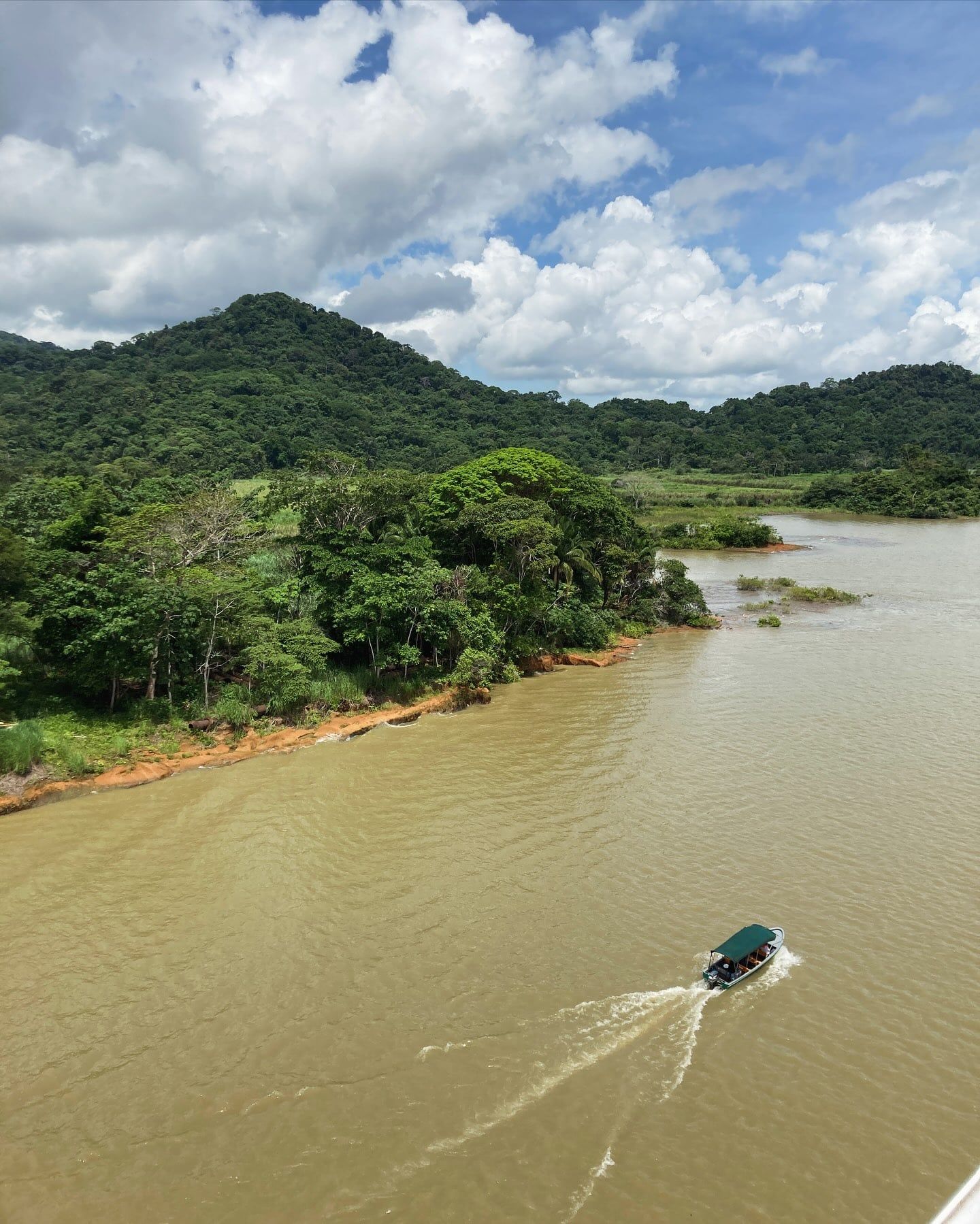
Gatun Lake dictates the economic rhythm of Panama. The reservoir powers the canal, which generates a massive portion of the national GDP. Beyond global commerce, the lake supplies drinking water to millions of residents in Panama City and Colón. The daily lives of Panamanians depend on the seasonal rains that fill the Chagres River basin. Droughts directly threaten both the local water supply and international supply chains, forcing the Canal Authority to reduce ship drafts during dry years. The lake acts as the physical heart of the country's infrastructure.
The lake functions as a living laboratory for global tropical biology. The Smithsonian's century-long presence on Barro Colorado Island has produced thousands of scientific papers, shaping modern understanding of rainforest ecology. Researchers from around the world travel to the lake to study the isolated monkey populations and the unique adaptations of the local flora. Local indigenous and rural communities, while displaced during the initial 1913 flooding, now participate heavily in the eco-tourism economy. Guides from nearby towns pilot the small skiffs, locating specific monkey troops and bird nesting sites for visiting researchers and tourists.
Sport fishing culture thrives along the shoreline. The invasive peacock bass, known locally as sargento, provides a primary protein source for lakeside residents. Fishermen launch from the Gamboa Marina at dawn, navigating the quiet edges of the lake to cast near the submerged timber. The lack of bag limits on the peacock bass allows local families to harvest the fish freely. Anglers also target snook and rainbow bass in the deeper channels. Bring a heavy-duty rod if you target the 100-pound tarpon that occasionally migrate into the freshwater system from the Atlantic Ocean.
The historical ruins of Fort San Lorenzo sit just a 30-minute drive from the lake, overlooking the mouth of the Chagres River. This Spanish colonial fortress once guarded the river entrance long before the dam existed. Today, the ruins connect the modern engineering of the lake to Panama's colonial past. Visitors can trace the route of Spanish gold from the old fortress up the river to the modern locks. Hire a knowledgeable local guide and secure a private boat for your lake excursion to fully understand the layers of history surrounding the water.
Each ship transit drains 52 million gallons of Gatun Lake's fresh water into the ocean.
Anglers can catch unlimited peacock bass because the fish is an introduced, non-native species.
Petrified tree stumps from the 1913 valley flooding still sit just below the water's surface.
The Panama Canal Authority prohibits all swimming due to heavy ship traffic and American crocodiles.
Barro Colorado Island has operated as a Smithsonian tropical research station since 1923.
The islands scattered across the lake are actually the peaks of former mountains.
Heavy rainfall in October and November regularly causes flash floods and landslides along the shoreline.
Gatun Lake was formed in 1913 by damming the Chagres River. The project flooded a massive wooded valley, turning former mountain peaks into islands and creating the largest artificial lake of its era.
No. The Panama Canal Authority strictly prohibits swimming anywhere in the lake. The waters are heavily trafficked by massive cargo ships and populated by American crocodiles.
The lake supports three species of monkeys: mantled howler monkeys, white-faced capuchins, and Geoffroy's tamarins. Visitors also frequently spot spectacled crocodiles, iguanas, bats, and hundreds of bird species.
Non-resident adults pay B/.10.00, while children aged 6 to 12 pay B/.5.00. National adults pay B/.3.00, national seniors pay B/.1.50, and children under 6 enter for free.
December through May offers the best conditions. These months fall outside the heavy rain season, providing calmer waters for boat tours and more active wildlife viewing.
The lake sits about 50 miles from Panama City. The drive takes approximately one hour via the Pan-American Highway to reach the Gatun Dam area.
Barro Colorado is the largest island in Gatun Lake and a major biological reserve. The Smithsonian Tropical Research Institute has operated a research station there since 1923, studying its 480 tree species.
Peacock bass dominate the lake after being accidentally introduced in 1958. Anglers also catch snook, rainbow bass, and massive tarpon weighing up to 100 pounds.
A standard boat tour or visit to the Agua Clara Visitor Center takes 3 to 4 hours. Full-day itineraries combining a cruise with jungle hikes take 5 to 7 hours.
Wear lightweight, quick-dry clothing to handle the intense tropical humidity. Bring a wide-brimmed hat, polarized sunglasses, and a waterproof bag to protect electronics from sudden wake splashes.
Browse verified tours with free cancellation and instant confirmation.
Find Tours